|
|
Site-Centred - Cassini Mapping |
15
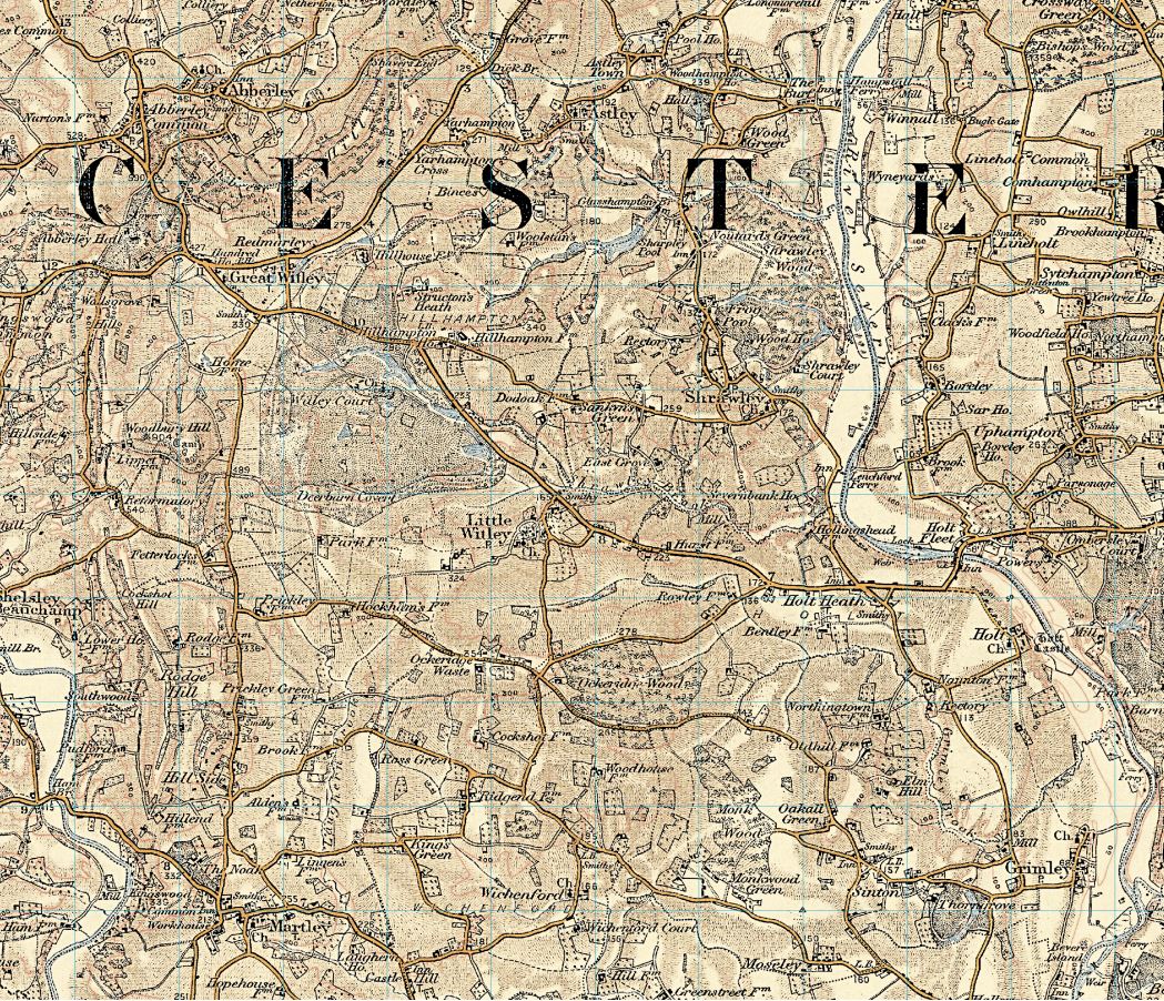
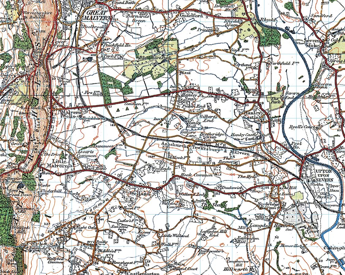
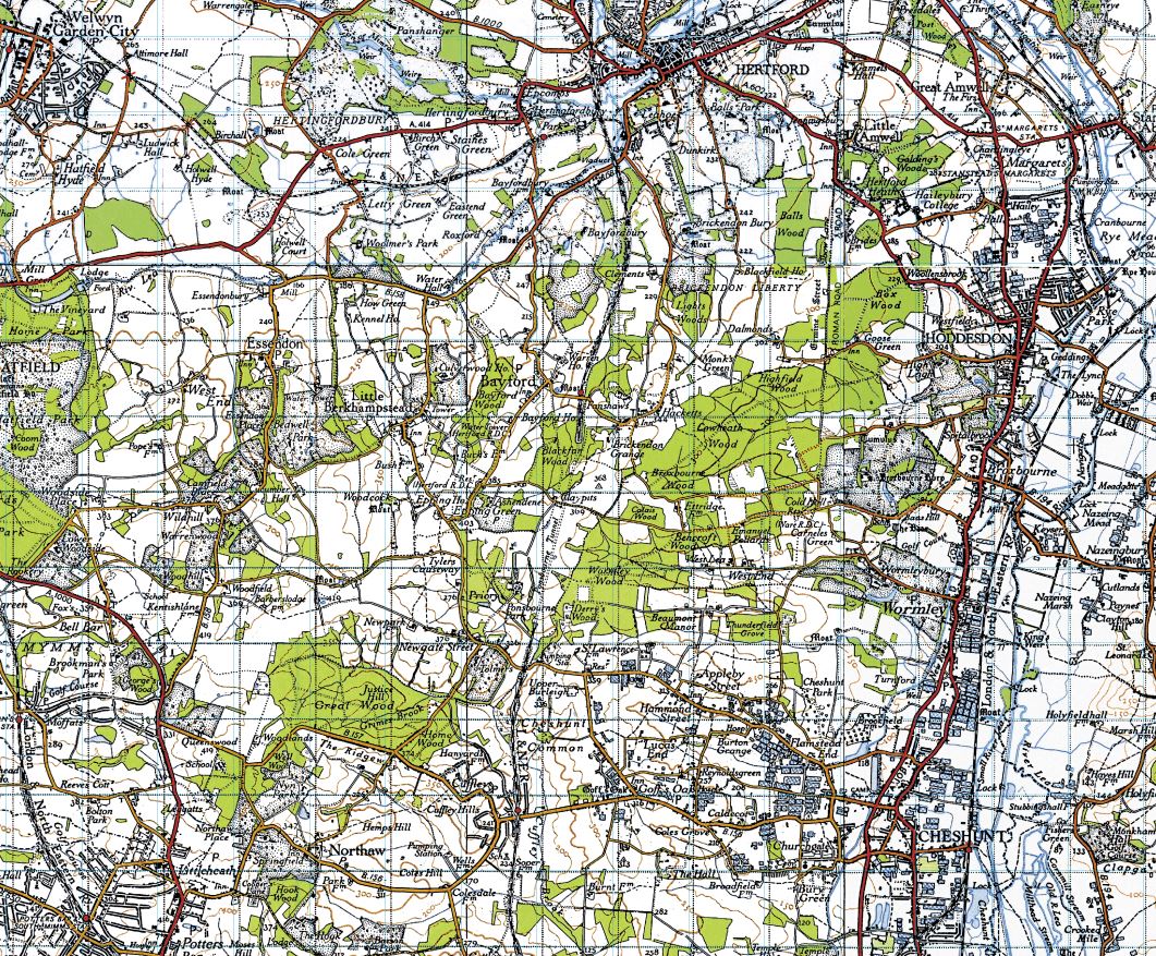
High Street, Upton upon Severn |

|
Site-Cented Cassini Mapping Cassini's maps
are digitally enhanced reproductions of the original Ordnance Survey
maps covering both England and Wales. These include the We can produce customised site-centred maps of your choice, centred on your desired location. To order you
own site centred Cassini map, see the listing of all the available
mapping series below, along with their approximate dates. When ordering, you will need to choose and specify -
|
||
 |
County
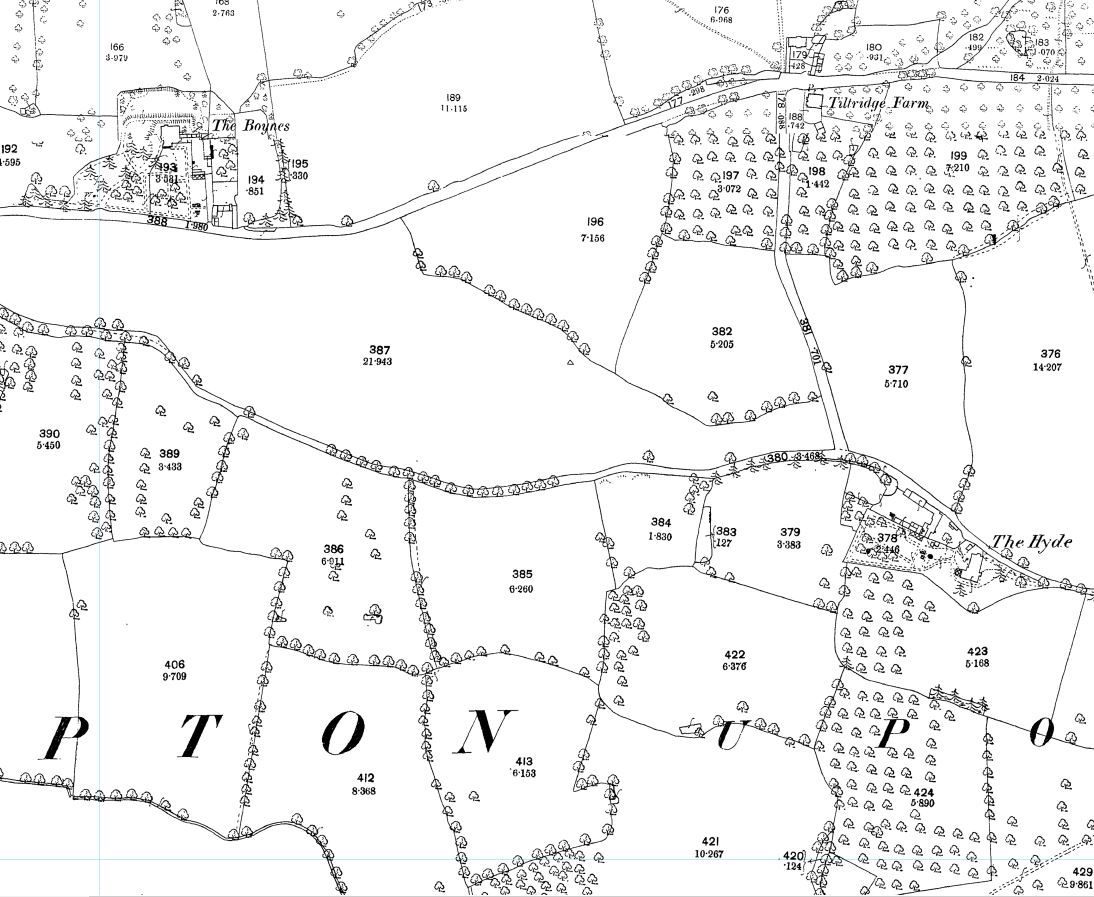
Series 1:2500 - Dated between 1853-1896
Scale:1:2500 The origins of the 1:2500 maps date back to 1840 when it had been decided to extend the 1:10,560 series mapping project to cover the whole of Great Britain. However, it soon became clear that more detailed maps were needed. After prolonged debate about the scale, format, and cost of the new surveys it was eventually agreed that the whole country would be surveyed at 1:2,500 except for areas of moorland and mountain where 1:10,560 was deemed sufficient. It was the first Ordnance Survey series to use a metric scale from the outset and is this the only one which has not bee necessary for Cassini to enlarge for it to match present-day mapping |
|
 |
County
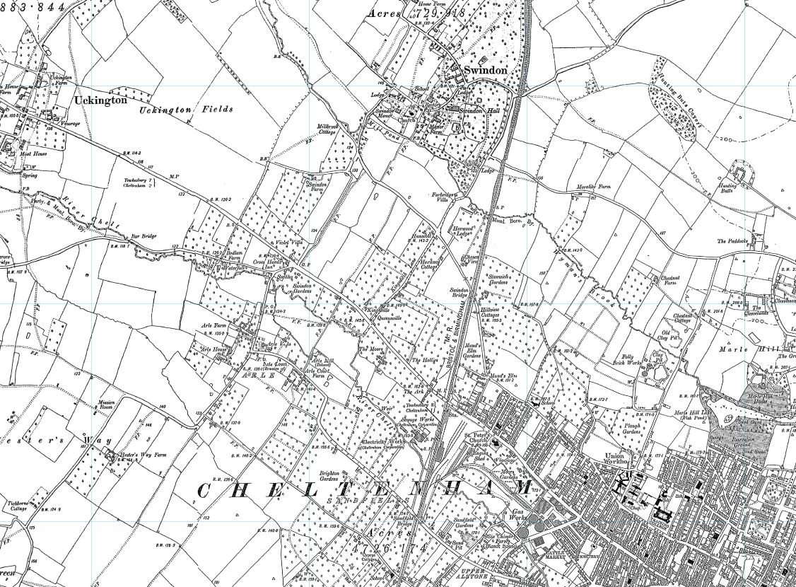
Series Six Inch - Dated between 1846 - 1910
Scale 1:10,000 The origins of the six inch to the mile maps date back to 1824 when this scale was adopted for a survey of Ireland. By 1840 it had been decided to extend the project to Great Britain. Work began in Lancashire and Yorkshire in 1841 and in Scotland in 1843 with the first sheet appearing in 1846. It was not until 1890 that maps covering the whole country had been published, a series known as the County Series. |
|
 |
Old
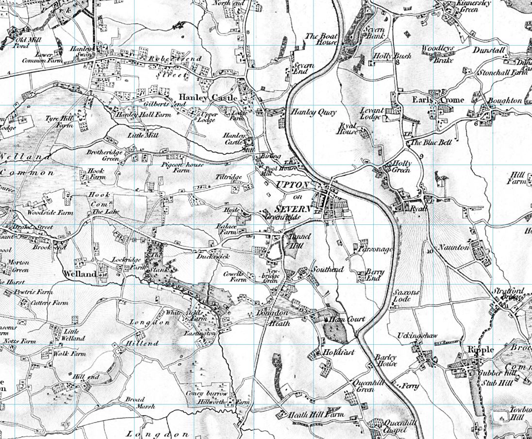
Series - Dated between late 1790s - 1874
Scale 1:50,000 These maps were the result of the first ever national survey of England & Wales and provide a snapshot of the human geography of Britain in the mid-19th century. These maps are taken from the Ordnance Survey One-Inch 'Old Series' sheets, surveyed between 1791 and 1874 and published - with many revisions and new editions - between 1805 and 1874. The Ordnance Survey's 19th-century cartographers managed to create, without most of the technology that today's map-makers take for granted, an elegant and accurate survey of Britain at this crucial time in history. |
|
 |
Revised
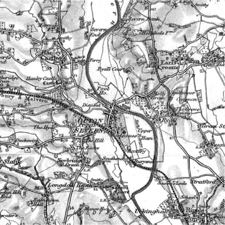
New Series - Dated between 1893 - 1904
Scale 1:50,000 Within a few decades of the first appearance of the Old Series, it had become clear that the process of surveying, revising and re-publishing maps of Britain was to be a never-ending task. During the 1840's the government and Ordnance Survey took several measures to address this. Following surveys at the six-inch and 1:2500 scale, Ordnance Survey began work on re-surveying the country. From this they obtained the basis for a new one-inch map published between 1846 and 1890, and later to be known as the New Series. In 1893 a more thorough revision was undertaken which resulted in the publication from the early 1890s of a revision to the New Series - the Revised New Series. |
|
 |
Revised
New Series (Colour) - Dated between 1896 - 1904
Scale: 1:50,000 After a new survey in the early 1890s, the Revised New Series (in colour) was published from 1896, the first coloured one-inch map series. This captured both the variety of the natural landscape and the human influence of Britain's late-Victorian heyday. It is an immaculate record of a vibrant society on the threshold of a still greater period of development and urbanisation. It records countless reminders of the past, many of which were about to be swept away for good. For local historians, this is the final record of you part of the country before the changes brought by the motor car. If your interest is genealogical, the series coincides with the 1901 Census, showing the landscape your ancestors inhabited. |
|
 |
Popular
Edition - Dated between 1912 - 1926
Scale 1:50,000 The original Ordnance Survey Popular Edition series was published just after the First World War and was the first to be conceived from the outset as a mass-market product, and the first to be produced in full colour. The new technology was put to the test in catering for a wholly new market. If the railways were the transport revolution of the 19th century, the motor car was certainly that of the 20th - accurate, relevant and up to date maps ere needed. The Popular Edition provided them. For the first time the gradations of the road network were described, with each route being coloured according to its suitability or otherwise for motor traffic. |
|
 |
New
Popular Edition - Dated between 1945 - 1948
Scale 1:50,000 If the Old Series describes the age of the horse and cart, the Revised New Colour that of the railways and the Popular Edition that of the dawn of the motor car, the New Popular Edition of the late 1940. is perhaps the map of the planner. Many schemes were proposed in the post-war years, including motorways, airports, new towns, and retail parks. Many were implemented, others were not. The New Popular Edition elegantly captures the raw material which planners and developers were to use to create the Britain that we know today. |
|
Please contact us for further information
Tel:
01684 593146
Freephone (UK): 0800 085 40 80
email: themapshop@btinternet.com