 |
Geological Mapping |
15
High Street, Upton upon Severn |
| Home | Maps
& Guidebooks (no login needed) |
Help,
How to & Pricing |
Planning Applications | Buy Plans | Login/Register | Contact |
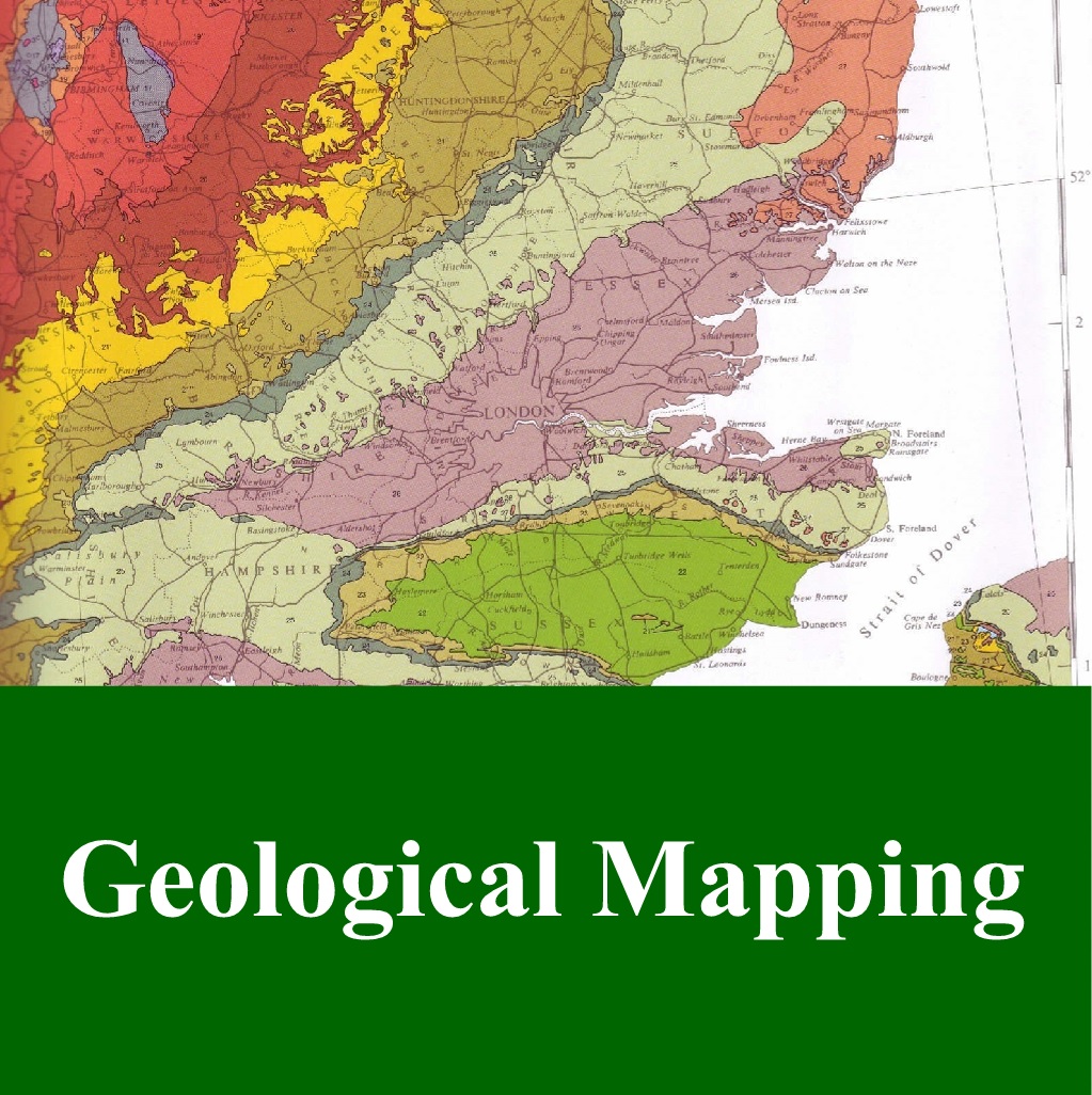
British Geological Mapping (BGS) is available in the following scales and formats:-
BGS 1:10000 geology overprinted on Ordnance Survey 1:10000 mapping. The product covers around 30% of the UK - as the product is not complete you will find greyed out areas where data is not available.
The mapping data is the most detailed geological mapping available from the British Geological Survey (BGS), consisting of four polygon layers.
As the 1/10000 Mapping only covers approx.. 30% of Britain we will provide information on availability and costs for any specified area.
1: 50000 British Geological Survey Mapping is available in 3 formats :-
1 - BGS 1/50000 - This product includes the most recent interpretation of the geology of Great Britain as mapped to 1:50,000 scale by the British Geological Survey. This is overlain on 1:50,000 mapping from the Ordnance Survey.
Although the geology of Great Britain remains largely unchanged over the geologically insignificant timescale of the human lifetime, there are constant updates to the mapping as the understanding of the often hidden 'surface' geology is improved by growing knowledge, technological advances in investigation and new exposure through excavation and natural ground movement.
2 - BGS GeoSure 1:50000 with background mapping - It is vital to determine the stability (and thus value) of land, property, and the safety of its occupiers. The GeoSure data sets from the British Geological Survey provide information about potential ground movement or subsidence in a helpful and consistent rating system.
3 - BGS 1:50,000 Geological Mapping and GeoSure Information for a full understanding of the rock types present and the implications that these have on potential slope stability, ground movement or subsidence.
The GeoSure component is complimented by the British Geological Survey 1:50,000 data which underpins the ratings given in the various GeoSure categories. Comparing the two datasets quickly reveals a deeper understanding of why risks may have been attributed to any given area.
The BGS Geological and GeoSure Data can help inform planning decisions and indicate causes of subsidence or instability.