 |
NW England |
15
High Street, Upton upon Severn Worcs. WR8 0HJ Tel: 01684 593146 or 0800 085 40 80 (UK only) themapshop@btinternet.com |
| Click here for Isle of Man | |||
| General Guides | |||
| £15.99 | Lake District - Rough Guide This practical guide to one of the most popular tourist destinations in the UK, is perfect for independent travellers planning a longer trip. Features detailed travel tips, itineraries, and all the must-see sights and off-the-beaten-track places. Presents highlights ranging from Castlerigg Stone Circle and the sculptures of Grizedale Forest to the serenity of Tarn Hows. Complete with maps and street plans for every region, as well as highlights and suggestions for what to do, places to visit, accommodation, restaurants, pubs, cafes etc. |
Order | |
| Long Distance Walking Routes | |||
| £17.95 | A Coast to Coast Walk - St Bees to
Robin Hood Bay - Cicerone Press Guide The Coast to Coast walk, popularised by Wainwright, runs from St Bees Head in Cumbria to Robin Hood’s Bay on Yorkshire’s east coast. At 178 miles (300km), this popular long-distance walk can be easily walked within a two-week holiday. Includes 1/25 000 Route Map Booklet |
Order | |
| £11.99 | Coast 2 Coast Challenge Map
- Discovery Waterproof Map Walk England Coast to Coast - a new approach to a Classic Adventure. This is a strip map at a scale of 1:40,000, with OS like maps, showing the Coast to Coast routes with distances and approximate timings. A GPS download is also available with this map. |
Order | |
| £12.99 | Coast to Coast Path
- Trailblazer Guide 109 large-scale maps & guides to 31 towns & villages |
Order | |
| £ 7.95 | Coast to Coast - Part 1, West (St Bees Head to Keld) - Footprint Map & Guide | Order | |
| £ 7.95 | Coast to Coast - Part 2 , East (Keld to Robin Hoods Bay) - Footprint Map & Guide | Order | |
| £15.99 | Coast to Coast Walk
- St Bees Head to Robin Hoods Bay - Wainwright Originally compiled in the 1950s early 1960s, the Wainwright walking guides are perhaps the most distinctive and unusual such guides ever devised. The result of research by their namesake and author over a period of 13 years, the guides have retained their original format and design to this day. The books contain intricate hand drawn sketches by the author, detailing routes of ascent, and gradients of the hills in and around the Lake District and outlying regions.;"A Coast to Coast Walk" was devised by Wainwright himself and stretches across 190 miles from St Bees Head on the East coast to Robin Hood's Bay on the West, passing through the Lake District, Yorkshire Dales and North York Moors. |
Order | |
| £16.95 | Walking the Cumbria Way - Cicerone Press Guide A guidebook to the 73-mile Cumbria Way, an easy long-distance walk though the heart of the Lake District National Park, from Ulverston in the south to Carlisle in the north, with good transport links to either end. The route is largely low-level but this guide offers alternative mountain days to climb some of the famous fells en route |
Order | |
| £17.95 | 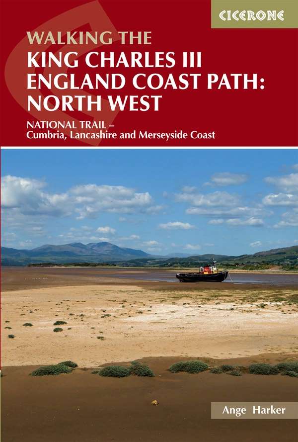 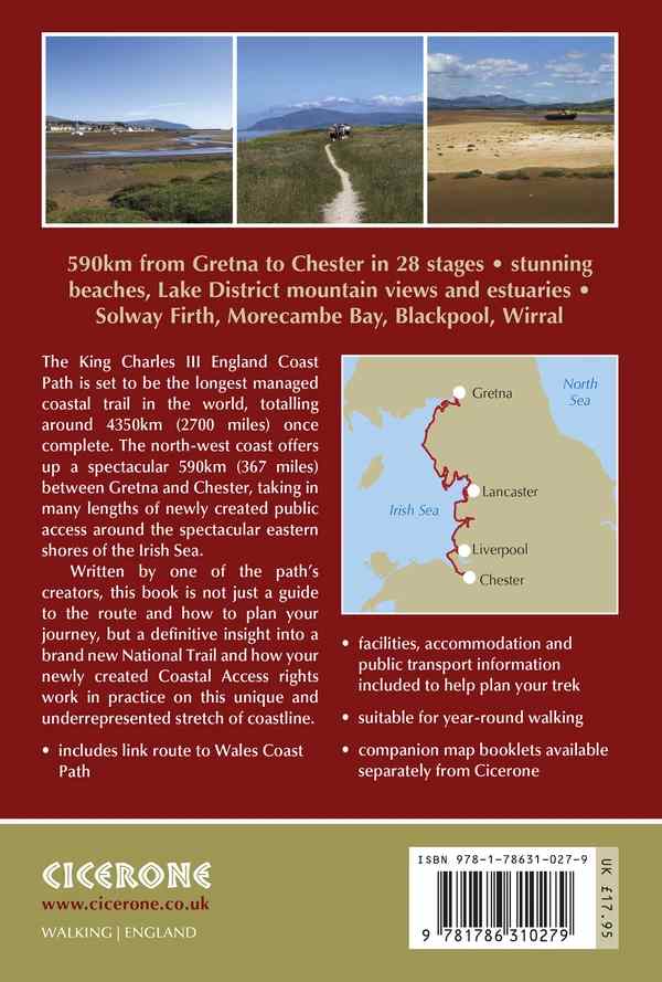 |
King Charles 3rd England Coast Path: North West - Cicerone Press Guide - National Trail - Cumbria, Lancashire & Merseyside Coast A guidebook to walking the northwest section of the King Charles III England Coast Path between Gretna and Chester. Covering 590km (367 miles), this straightforward trail along the Cumbria, Lancashire and Merseyside coast takes around 1 month to hike. The route is described from north to south in 28 stages between 13 and 29km (8–18 miles) in length. Contains step-by-step description of the route alongside 1:50,000 OS maps, Refreshment information given for each route stage, Public transport by stage is listed for those wanting to break the trail into shorter sections, Handy trek planner, route summary tables and accommodation listings help you plan your itinerary, Accompanying map booklets containing OS 1:25,000 mapping and route line are also available (See below) |
Order |
| £12.95 | 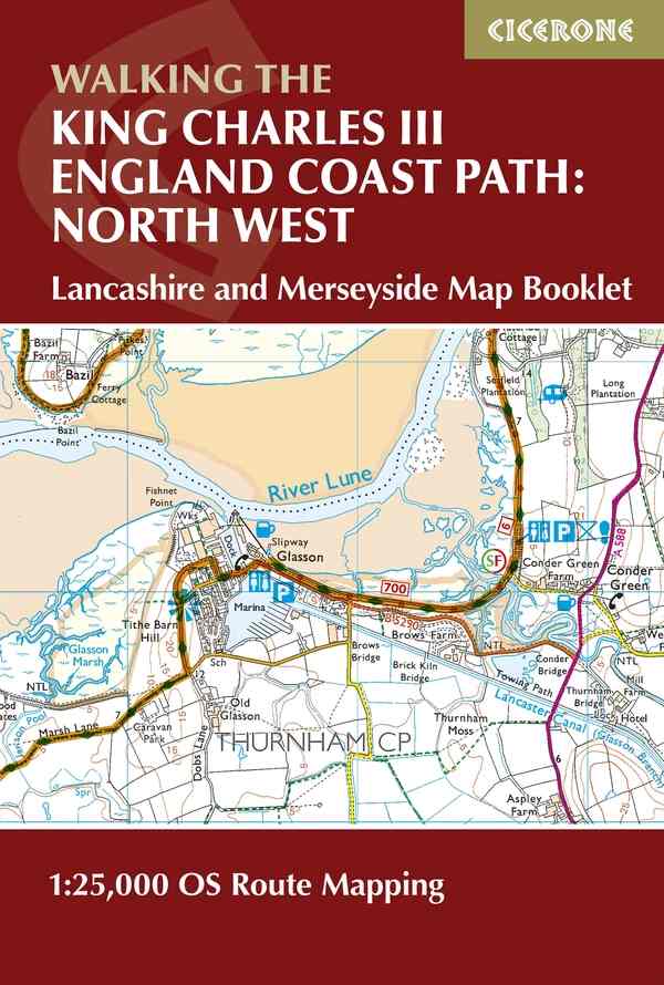 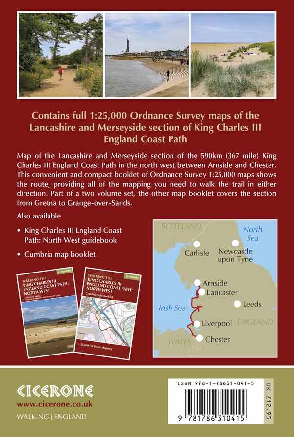 |
King Charles 3rd England Coast Path: North West - Cicerone Press Guide - Lancashire & Merseyside Coast - OS 1/25 000 Route Booklet Map of the southern section of the 590km (367 mile) England Coast Path: North West National Trail. Covers the trail between Arnside and the Welsh border along the Lancashire and Merseyside coastline. This compact booklet of OS 1:25,000 maps shows the route, providing all of the mapping you need to walk the trail in either direction. TO ORDER ONLY |
Order |
| £12.95 | 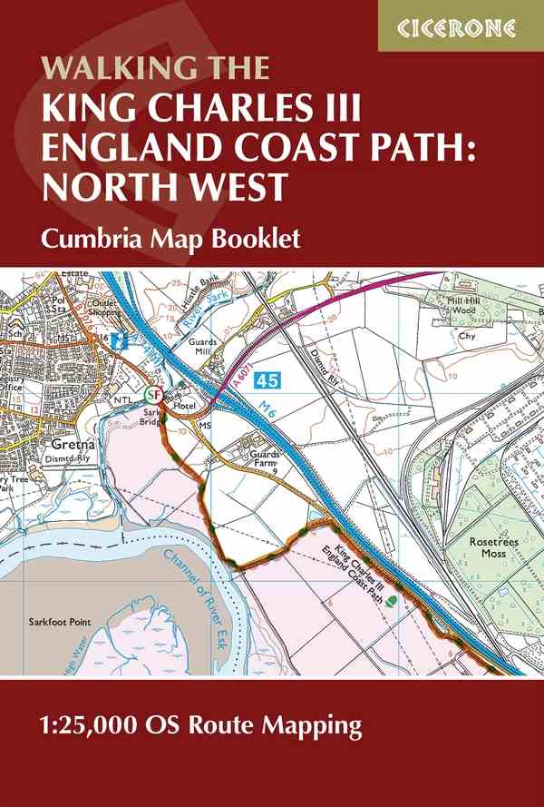 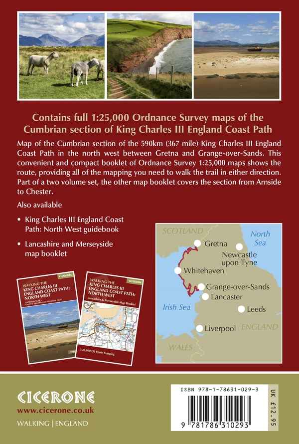 |
King Charles 3rd England Coast Path: North West - Cicerone Press Guide - Cumbria - OS 1/25 000 Route Booklet Map of the Cumbrian section of the 590km (367 mile) England Coast Path: North West National Trail. Covers the trail between Gretna and Grange-over-Sands along the Cumbrian coastline. This convenient and compact booklet of OS 1:25,000 maps shows the route, providing all of the mapping you need to walk the trail in either direction. TO ORDER ONLY |
Order |
| £16.95 | Ribble Way - Cicerone Press Guide - A one week walk across Lancashire into Yorkshire fro Preston to the source. 72 miles described in 7 stages. | Order | |
| £ 8.99 | Joining the Seas: A Yorkshire Man's Coast to Coast - Cordee | Order | |
| Walking Guides | |||
| £ 6.99 | Forest of Bowland
- Short walks made easy - OS Walking Guide 10 leisurely walks in the North Lancashire area of outstanding natural beauty, illustrated with easy-to-follow maps and route profiles, and notes on the local wildlife and 'stories behind each walk' |
Order | |
| £11.95 | Walking in the Forest of
Bowland & Pendle - Cicerone Press Guide 40 circular walks in two of Lancashire's largest Areas of Outstanding Natural Beauty – the Forest of Bowland and nearby Pendle. From rough uplands to gentle riverside strolls. Illustrated with OS mapping |
Order | |
| £12.95 | Walking in Cumbrias
Eden Valley - Cicerone Press Guide Walking guide to 30 day walks in the Eden Valley, in the north of Cumbria, following the River Eden from Kirkby Stephen past Penrith and Carlisle to the Solway Firth. A wide range of day routes, from 4 to 17 miles in length, past castles, churches and prehistoric settlements with views of the Lake District, Pennines and Scottish hills. |
Order | |
| £ 6;99 | Lake District -
Short walks made easy - OS Walking Guide 10 carefully selected leisurely walks, illustrated with easy-to-follow maps and route profiles, and notes on the local wildlife and 'stories behind each walk' |
Order | |
| £13.99 | AA 50 Walks in Lake District | Order | |
| £ 6.99 | Top 10 Walks - Ridge Walks & Scrambles - Challenging high level routes in the Lake District | Order | |
| £ 9.95 | 15 Short Walks in
the Lake District - Windermere,
Ambleside & Grasmere - Cicerone Press Guide Walks under 3 hours plus 1 Challenge route, OS mapping |
Order | |
| £ 9.95 | 15 Short Walks in Arnside & Silverdale (Walks under 3 hours plus one challenge route with easy-to-follow route descriptions and OS mapping) - Cicerone Press Guide | Order | |
| £ 6.99 | The Lake District - 40 favourite walks | Order | |
| £16.95 | Tour of the Lake
District - Cicerone Press Guide A 145km (90 mile) circular walking route from Ambleside around the Lake District National Park, visiting all the main valleys and local centres. Described in 9 stages, with 5 high-level alternatives. |
Order | |
| £12.99 | Walk! The Lake District South - Discovery Guide (GPS compatible) Each walking route itinerary includes:- walking route summary, ratings for Effort, Time, Distance, Ascents/Descents, Refreshments and Vertigo risk, fully detailed walk description, including frequent timings to aid navigation and check your progress, GPS Waypoints at every key point on every route for pin-point navigational accuracy, full colour 1:40,000 scale map of the route, short walk and stroll alternatives. There are some easy routes. There are some challenging routes for fit experts. With Charles Davis’ excellent walk descriptions you’ll know which routes are for you - and all of them are a true adventure. |
Order | |
| £ 8.99 | Easy miles. No steps and stiles in and around the Lake District - Cordee | Order | |
| £12.99 | Lake District - Pathfinder Guide No 60 | Order | |
| £11.99 | Eastern Lakeland - Pathfinder Guide No 59 | Order | |
| £ 5.99 | Walking Country Lakeland Fells - Patterdale & the East - Hannon - Includes Helvellyn, Ullswater, High Street | Order | |
| from £12.99 |
each | Lakeland Fells -
Wainwright Series Vol 1 - The Eastern Fells - Walkers Edition revised by Clive Hutchby - £14.99 |
Order |
| Vol.2 - Far Eastern Fells - Second Edition revised by Chris Jesty - £12.99 | Order | ||
| Vol.3 - The Central Fells - Walkers Edition revised by Clive Hutchby £14.99 | Order | ||
| Vol 4 - The Southern Fells - Walkers Edition revised by Clive Hutchby - £14.99 | Order | ||
| Vol 5 - The Northern Fells - Walkers Edition revised by Clive Hutchby - £14.99 | Order | ||
| Vol.6 - The North-West Fells - Walkers Editon revised by Clive Hutchby - £14.99 | Order | ||
| Vol.7 - The Western Fells - Walkers Edition revised by Clive Hutchby - £13.99 | Order | ||
| £12.99 | Lakeland Fell
Ranger - Near Eastern Fells - Cicerone Press Guide Guidebook containing detailed introductions to walking 35 summits in the Near Eastern Fells of the English Lake District, including a variety of ascents, old and new, in the mighty range of hills that sit between Ambleside, Ullswater and Grasmere |
Order | |
| £14.95 | Lakeland Fell
Ranger - Southern Fells - Cicerone Press Guide Walking guide by Mark Richards covering 23 summits in the Southern Fells of the English Lake District, including a wide range of ascents, old and new, between Wrynose and Hardknott passes and Black Combe in the south and Muncaster in the west. |
Order | |
| £12.95 | Walking in Lancashire
- Cicerone Press Guide Lancashire has a great variety of landscape, and this guide describes 40 walks along its rivers and coastline, by its woodlands, hills and moors, and to its villages and historic sites. The walks, from 5 to 12 miles in length, range from gentle strolls to fell-top hikes. |
Order | |
| £12.95 | Lune
Valley & Howgills Walking Guide - Cicerone Press A pocket-sized guidebook to 40 walks, from 3 to 11 miles, exploring the varied landscape of the Lune Valley and Howgill Fells, some of the most unspoilt countryside in northwest England. Set between the Lake District and the Yorkshire Dales and two other AONBs, the walking is hugely rewarding, with magnificent views and woodland full of wildlife |
Order | |
| £ 9.95 | 15 Short Walks - Ribble Valley Includes Ribchester, Longridge, Whalley, Pendle, Clitheroe, Waddington & Downham |
Order | |
| £12.95 | Walks in the Silverdale /
Arnside - Cicerone Press This guide covers the Silverdale AONB and area, with the north-west’s most beautiful coastal scenery and a naturalist’s paradise. Takes in Arnside, Beetham and Levens Hall, plus the surprising Farlton Fell and Hutton Roof area overlooking the Lancaster Canal. Often dry when the Lakes are wet. |
Order | |
| Climbing Guides | |||
| £15.00 | Winter Climbs in the Lake District
- Snow, Ice and mixed climbs in the English Lake Distict - Cicerone Press Every known winter climb from every part of the Lake District is described in a fresh new format – nearly 1000 routes in all. From classic high-mountain gullies to frozen watercourses and icefalls. A joint production by the Fell and Rock Climbing Club and Cicerone Press. |
Order | |
| £18.95 | Scrambles in the Lake District - North - Cicerone Press Guide | Order | |
| £18.95 | Scrambles in the Lake District - South - Cicerone Press Guide | Order | |
| £20.00 | Scafell & Wasdale - Fell & Rock Climbing Club Guide - To order only | Order | |
| Cycling Guides | |||
| £ 9.95 | 1/90 000 | C2C cycle route - Footprint map (waterproof) | Order |
| £12.95 | C2C Cycle Route - Cicerone
Press Guide New guide to the Coast to Coast (C2C) Sustrans cycle route, across the UK, from Whitehaven or Workington to Tynemouth or Sunderland, through the English Lake District, the Eden Valley and the Pennines. 140 miles mostly on cycle paths, forest tracks and minor roads with off-road options and taster day rides described. For all abilities. |
Order | |
| £16.50 | C2C West - Harveys MTBikers and Cyclists Map | Order | |
| £16.50 | C2C East - Harveys MTBikers and Cyclists Map | Order | |
| £14.99 | Lost Lanes in North England - 36 rides | Order | |
| £11.95 | Cycling Hadrian's Cycleway - Cicerone Press Guide (174 miles, Ravenglass to South Shields) | Order | |
| £ 8.99 | Cycle Map 22 (Lovell Johns) - Lake District & Cumbria | Order | |
| £16.95 | Cycling in the
Lake District - Cicerone Press Guide The 179km/112 mile Fred Whitton Challenge and an alternative 5-day cycle tour of the Lake District, as well as 15 tough day rides throughout the National Park. |
Order | |
| £16.95 | Mountain Biking - Lake District
- Vertebrate Publishing Essential Trails - Compact guide to riding in one of the best mountain biking areas in the UK.- 27 routes from 12-60km long. Graded for difficulty and plotted on Harveys Maps |
Order | |
| £14.95 | Mountain Biking in
the Lake District - Cicerone Press Guide 24 original and exciting graded routes throughout the national park for riders of all abilities, including a full circumnavigation of Windermere. |
Order | |
| £12.95 |
The Lancashire Cycle Way - Cicerone Press Guide The Cycleway comprises two distinct loops, each around 130 miles (225km) in length, which meet at Whalley in the Ribble valley. Seasoned cycle-tourists can tackle either loop in a weekend. The difficulty varies from easy roads in the west to the challenges found in the West Pennine Moors and the Bowland Fells. |
Order | |
| £ 9.99 | Reivers Cycle Routes Map (1/50 000) - Cordee - coverage | Order | |
| £ 7.95 | Reivers Cycle Route - 172m - Whitehaven to Tynemouth - Footprint Map | Order | |
| £14.95 | Cycling the Way of the Roses
- Across Lancashire & Yorkshire - Cicerone Press Guide Guidebook to cycling the Way of the Roses across Lancashire and Yorkshire, from Morecambe to Bridlington. A 170 mile coast to coast across the north of England split into 3 days, with alternative 4 and 5 day itineraries outlined. Maps and route profiles are provided for each stage, with advice on preparation, equipment and accommodation. |
Order | |
| NB: National Cycle Network Pocket (Sustrans) Maps: Note that some of these are temporarily unavailable. Some still left in stock. | |||
| £11.95 | Sea to Sea - Sustrans Map/Guide - 136 mile route Whitehaven or Workington to Sunderland or Newcastle- Temporarily unavailable | Order | |
| £ 9.99 | The Bay Cycle Way - 81 miles - Walney Island to Glasson Dock - Sustrans (view coverage) | Order | |
| £ 9.99 | Hadrian's Cycleway - Sustrans Map - 174 mile route from Ravenglass to South Shields - Temporarily unavailable | Order | |
| £14.99 | Circular day rides North - 75 rides 20-30 miles - Sustrans | Order | |
| £ 5.95 | Trans Pennine Trail Central - Irish Sea to Yorkshire Map | Order | |