 |
Map of the Month |
15
High Street, Upton upon Severn Worcs. WR8 0HJ Tel: 01684 593146 or 0800 085 40 80 (UK only) themapshop@btinternet.com |
| Home | Great
Britain Maps & Guides |
European Maps & Guides |
Rest
of the World Maps & Guides |
Search |
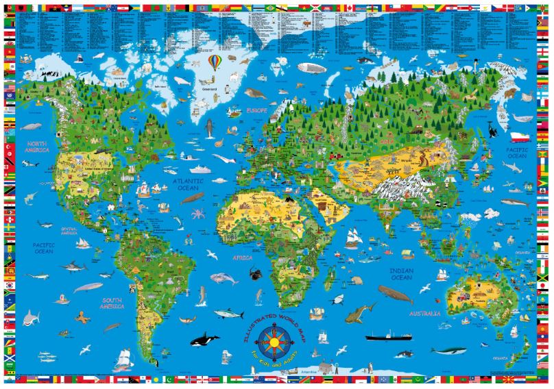
| Children (& Adult's) Illustrated Map of the World Size of map: 135cm x 95cm A fun, educational way of displaying the world to younger explorers, with bright and colourful illustrations that attract interest and attention to different areas of the world. It is as informative as it is entertaining and gets us closer to the world we are living in. The map is framed with images of country flags, alphabetically arranged, and labelled. Popular with all ages. Order |
 |