 |
Administrative Maps |
15
High Street, Upton upon Severn Worcs. WR8 0HJ Tel: 01684 593146 or 0800 085 40 80 (UK only) themapshop@btinternet.com |
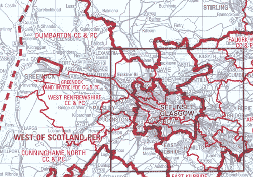
Administrative boundary maps are definitive graphic maps outlining all unitary, local authority, European and Westminster parliamentary boundaries in Great Britain. Administrative boundary maps are ideal for identifying which local authorities need to be contacted when planning large ventures such as road construction or building projects. They are also a useful addition to archival records in libraries, educational and legal establishments and local government offices.
Suggested applications
-
Planning and analysis
-
Education and research
There are eight maps at 1:250 000 scale which together cover the whole of Great Britain, following the sheet lines of the OS Road Maps series (shown below), showing unitary and local authority boundaries.
A further two at 1:625 000 cover the whole of the country, indicating European and Westminster boundaries (The 1/625 000 maps do not show county & district information only parliamentary).
Features and benefits
- Revised in accordance with significant boundary change generating a graphical representation of administrative boundary information in Great Britain.
- When overlaid on Ordnance Survey small-scale mapping, boundary information easily relates to roads, towns or other features
- Colour-coded information allows easy identification of different boundaries and areas
These maps are priced at £18.45 each
| ORDER ONLINE |