 |
Ireland - incl. Northern Ireland |
15
High Street, Upton upon Severn Worcs. WR8 0HJ Tel: 01684 593146 or 0800 085 40 80 (UK only) themapshop@btinternet.com |
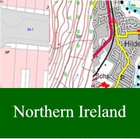 |
Ordnance
Survey of Northern Ireland Plans, Planning Maps & Plans for Land
Registry We offer the most detailed, current and comprehensive map datasets using Ordnance Survey of Northern Ireland's Survey and Mapping within the Northern Ireland Land and Property Services. You can quickly mark out your area of interest, before taking the map as either a scaled Print or PDF, or as a Data Export for your CAD or GIS system Click here for more information |
||||
| Panoramic Mapping - Click here | |||||
| Maps - Ordnance Survey & other publications of Ireland & Northern Ireland | |||||
| £10.99 | each | 1/50 000 | Discovery Maps for the Republic of Ireland in 89 sheets | Order | View Index |
| £10.99 | each | 1/50 000 | Discoverer Maps for Northern
Ireland Sheet No 4 - Coleraine |
Order | View Index |
| Sheet No 5 - Ballycastle | Order | ||||
| Sheet No 7 - Londonderry | Order | ||||
| Sheet No 8 - Ballymoney | Order | ||||
| Sheet No 9 - Larne | Order | ||||
| Sheet No 12 - Strabane | Order | ||||
| Sheet No 13 - The Sperrins - Temporarily Unavailable | Order | ||||
| Sheet No 14 - Lough Neagh | Order | ||||
| Sheet No 15 - Belfast | Order | ||||
| Sheet No 17 - Lower Lough Erne | Order | ||||
| Sheet No 18 - Enniskillen | Order | ||||
| Sheet No 19 - Armagh | Order | ||||
| Sheet No 20 - Craigavon | Order | ||||
| Sheet No 21 - Strangford Lough | Order | ||||
| Sheet No 27 - Upper Lough Erne | Order | ||||
| Sheet No 28 - Monaghan | Order | ||||
| Sheet No 29 - The Mournes | Order | ||||
| £10.99 | 1/450 000 | OSI - Ireland Touring Map - One of Irelands most popular maps featuring detailed road network, holiday information, scenic routes and city maps. As a bonus this map includes distance chart and index to cities, towns & villages. | Order | ||
| £10.99 | 1/450 000 | OSI - Ireland Driving Map - Up to date road network, Index to cities, towns & villages. Distance chart | Order | ||
| £10.99 | each | 1/250 000 | OSI Touring Maps
- 4 sheets for full coverage East Sheet |
Order | View Index |
| West Sheet | Order | ||||
| North Sheet | Order | ||||
| South Sheet | Order | ||||
| £16.99 | 1/25 000 | OSI Adventure Series Map - Aran Islands | Order | ||
| £16.99 | 1/25 000 | OSI Adventure Series Map - Clew Bay, Croagh Patrick & Clare Island | Order | ||
| £16.99 | 1/25 000 | OSI Adventure Series Map - Lough Allen | Order | ||
| £16.99 | 1/25 000 | OSI Adventure Series Map - Lough Derg | Order | ||
| £16.99 | 1/25 000 | OSI Adventure Series Map - Lough Ree | Order | ||
| £16.99 | 1/25 000 | OSI Adventure Series Map - Maggillycuddy's Reeks and Killarney National Park | Order | ||
| £16.99 | 1/25 000 | OSI Adventure Series Map - South Mayo | Order | ||
| £16.99 | 1/25 000 | OSI Adventure Series Map - Wicklow Central (Lugnaquillia, Glendalough & The Devils Glen) | Order | Coverage | |
| £16.99 | 1/25 000 | OSI Adventure Series Map - Wicklow North (Blessington, Kippure & The Great Sugar Loaf) | Order | ||
| £16.99 | 1/25 000 | OSI Adventure Series Map - Wicklow South (Tinahely, Annagh Hill & The Vale of Avoca) | Order | ||
| £10.99 | 1/25 000 | Glens of Antrim - OSNI Activity Map (includes waymarked walks, scenic routes and points of interest) | Order | ||
| £10.99 | 1/25 000 | Causeway Coast &
Rathlin Island - OSI Activity Map (Includes waymarked walks, canoe trail access points, scenic drives, Giant's Causeway World Heritage Site and the Route of the North West 200) |
Order | ||
| £10.99 | 1/25 000 | Lough Erne - OSNI Activity Map (with easy to use navigation guide. Includes local attractions, hiking and biking trails) | Order | ||
| £10.99 | 1/25 000 | Strangford Lough - OSNI Activity Map (Includes nature reserves, National Trust properties and country parks) | Order | ||
| £12.99 | 1/25 000 | Wild Nephin (water resistant paper) - Definitive Nephin Beg mountain region. Covers Ballycroy National Park, Wild Nephin Wilderness Area - Temporarily unavailable | Order | ||
| Other Publishers | |||||
| £ 6.99 | 1/400 000 | Michelin Sheet 712 - very good road map for whole of Ireland | Order | ||
| £12.99 | 1/30 000 | Wicklow Mountains West - Eastwest Mapping Water Resistant paper | Order | Coverage | |
| £16.99 | 1/80 000 | Map of County Clare (Waterproof - Showing walking & cycling routes) - Xploreit | Order | ||
| £18.99 | 1/100 000 | Map of County Cork (Waterproof - Showing walking & cycling routes) - Xploreit | Order | ||
| £18.99 | 1/100 000 | Map of County Mayo & Sligo (Waterproof - Showing walking & cycling routes) - Xploreit | Order | ||
| £16.99 | 1/100 000 | Map of County Kerry - Xploreit | Order | ||
| £16.99 | 1/100 000 | County Map of Donegal, Ireland (Ideal for planning and touring) - Xploreit | Order | ||
| £19.95 | 2 miles to 1 inch | The Wild Atlantic Way Route Atlas - Derry to Kinsale - Fold out maps, Official discovery points Scenic Roads highlighted - Xploreit | Order | ||
| £12.00 | Ireland's Waterways Map and Directory | Order | |||
| £14.50 | 1/30 000 | Connemara - Harvey Map - The National Park, the Twelve Bens plus the Maumturks, on one sheet. An inset of Clifden is included. Names are in Gaelic and English and major access routes are shown - GPS Compatible & Waterproof | Order | Image | |
| £14.50 | 1/30 000 | Macgillycuddy's Reeks - Harvey Map - New detailed map of this popular and challenging walking area. Completely new survey from air photography, ground checked in 2006. Also includes the whole of the Killarney National Park and an enlargement of Carrauntoohil at 1:15,000. Waterproof. Supplied in a clear plastic pocket. - GPS Compatible & Waterproof | Order | Image | |
| £14.50 | 1/25 000 | Mourne Mountains
- Harvey Map The Mournes, a granite mountain range in County Down, includes the highest mountains in Northern Ireland. The highest is Slieve Donard at 850 metres. Detailed map for hillwalkers of the Mountains of Mourne at 1/25 000 scale. The Mournes is an Area of Outstanding Natural Beauty and has been proposed as the first national park in Northern Ireland. The area is partly owned by the National Trust and sees a large number of visitors every year. The Mourne Wall is among the more famous features in the Mournes. It is a 35km (22 mile) drystone wall that crosses fifteen summits, constructed in 1904 and completed in 1922 to define the boundaries of land purchased by the Belfast Water Commissioners in the late 1800's. Includes The Mourne Way Long Distance Footpath. |
Order | ||
| £15.50 | 1/30 000 | Wicklow Mountains - Harvey Map - Includes the spectacular Glendalough area & sections of St. Kevin's Way & Wicklow Way, which cross the mountains. National Park boundary shown. - GPS Compatible & Waterproof | Order | Image | |
| Wall Maps - Unfortunately we cannot send any wall maps overseas | |||||
| £ 9.99 | 1/550 000 | Ireland Wall Map - Political - Global Mapping (Paper - 695 x 850 mm) | Order | ||
| £23.99 | 1/550 000 | Ireland Wall Map - Political - Global Mapping (Laminated - 695 x 850 mm) | Order | ||
| £16.99 | 1/400 000 | Ireland Wall Map - Michelin (Encapsulated - 1000 x 1110 mm) | Order | ||
|
Unfortunately we cannot send any wall maps overseas |
|||||
| Road Atlases | |||||
| £14.99 | 1/210 000 1" to 3.3 miles |
Ordnance Survey Complete Road Atlas - Ireland (Spiral) - Currently Not Available | Order | ||
| £ 6.99 | 9 miles to 1" | Collins Handy A5 Road Atlas - Ireland Main large scale mapping at 9 miles to 1". Easy journey planning, popular places of interest, also shows Blue flag and Green Coast Beaches. |
Order | ||
| £ 9.99 |
1/200 000 3.2miles to 1" |
Collins A4 Comprehensive Road Atlas - Ireland (Spiral) - Includes 15 town and city centre maps and Wild Atlantic Way | Order | ||
| Street Maps | |||||
| £10.99 | 1/10 000 | Armagh City (Includes street index, 1/50 000 district road map on reverse) - OSNI Street Map | Order | ||
| £10.99 | 1/15 000 | Cork (Includes street index, places of interest and city centre extract map 1/10 000) - OSI Street Map | Order | ||
| £10.99 | 1/13 000 | Limerick (Includes detailed street index, places of interest and historical extract) - OSI Street Map | Order | ||
| £10.99 | 1/10 000 | Newry (1/50 000 district map on the reverse) - OSI Map | Order | ||
| Guides | |||||
| £16.99 | Ireland - Rough Guide | Order | |||
| £15.99 | Ireland - Eyewitness Guide | Order | |||
| £19.99 | Ireland - Lonely Planet Guide | Order | |||
| £ 7.99 | Belfast & The Causeway Coast (with pull-out map) - Lonely Planet Pocket Guide | Order | |||
| £ 9.99 | Belfast - Pocket Weekender Rough Guide | Order | |||
| £ 7.99 | Cork, Kerry & Southwest Ireland - Lonely Planet Road Trips Guide - To Order Only | Order | |||
| £13.99 | Dublin City - Lonely Planet Guide | Order | |||
| £ 8.99 | Dublin - Lonely Planet Pocket Guide | Order | |||
| £ 7.99 | Galway & West Ireland - Lonely Planet Road Trips Guide - To Order Only | Order | |||
| Walking Guides | |||||
| £15.99 | Ireland's
Wild Atlantic Way Walking Guide - Collins Press Guide A handy, easy-use guide detailing the best walking routes along the Wild Atlantic Way |
Order | |||
| £25.00 | Exploring
Ireland's Wild Atlantic Way - A travel guide to the West Coast
of Ireland by David Flanagan & Richard Creagh The 3rd Edition of Exploring Ireland's Wild Atlantic Way is essential reading for anyone planning to visit the Atlantic coast of Ireland. Whether looking for ideas for weekend adventures or visiting from abroad you will find everything you need within this guide. This book's focus is on the outdoors - on getting out into the fresh air, the wind, the sun and the rain - and experiencing the incredible natural beauty found everywhere along the coast. Written entirely by humans, no AI used! The authors spent years researching this book, it is the fruit of a lifetime of trips and time living on the Wild Atlantic Way. Printed less than 20km from the Wild Atlantic Way by Walsh Colour Print in Castleisland, County Kerry. |
Order | |||
| Ł 6.99 | Northern
Ireland - Pocket Mountain Guide This pocket-sized guide features 40 walks ranging from the Causeway Coast and Rathlin island, Belfast to Dundrum Bay, The Mourne Mountains, Fermanagh and Lough Erne and The Sperrins and the northwest. With Detailed route descriptions, illustrated by beautiful photography and clear mapping. |
Order | |||
| £15.99 | Northern Ireland
Walking Guide - Collins Press This is a guide to the best walking routes in Northern Ireland, from rugged mountain peaks to spectacular coastal scenery, from challenging hill walks to shorter woodland and waterside excursions. Every part of the region is covered, from the mountains of Mourne to the Giant’s Causeway, from Fermanagh’s ‘lake district’ to the rolling Sperrins. Each route is illustrated with a clear sketch map; descriptions include detailed access information while points of interest are highlighted – flora and fauna, history, archaeology and folklore. |
Order | |||
| £ 8.99 | Belfast Walks - 25 walks ranging from 1-10 miles and 45 minutes - 1 hour. Easy to follow map of each walk. Information on history, flora and fauna guide | Order | |||
| £15.99 |
The Beara & Sheep's Head
Peninsulas - Collins Walking Guide 25 coastal and inland walks around the peninsulas, with detailed route descriptions and information on history, tradition and geology of the area. |
Order | |||
| £16.99 |
The Burren & The Aran Islands - Collins Walking Guide 17 walks varying from 2-6 hour walks to suit everyone with detailed route descriptions, a clear sketch map and points of interest |
Order | |||
| £15.99 |
Carrauntoohil & MacGillycuddy's Reeks - Collins Walking Guide Comprehensive guide containing 20 walks with detailed route descriptions and full-colour maps. Also includes information on the history, geology and wildlife of the area Temporarily Unavailable |
Order | |||
| £ 6.50 | Hillwalkers Guide to Carrauntoohil
& Macgillycuddy's Reeks - Sean Higgisson A selection of 12 hill walks also exploring Shehy Mountain, Tomies and Purple Mountain |
Order | |||
| £15.99 | The
Comeragh, Galtee, Knockmealdown & Sleive Bloom Mountains - Collins
Walking Guide 28 walks to suit everyone with detailed route descriptions and information on the history and landscape of the area |
Order | |||
| £ 8.99 | West Cork
Walking Guide 10 walks for casual stroller, family groups, ramblers and serious walkers, with clear detailed instructions |
Order | |||
| £ 6.50 | Hillwalkers Guide to County
Cork A selection of 12 coastal and mountain walks in Co. Cork with some in kerry, Waterford, Limerick and Tipperary |
Order | |||
| £12.99 |
Dingle Way - by Rucksack Readers A guidebook with detailed large scale mapping of the route stages, and useful information for planning |
Order | |||
| £15.99 |
The Dingle Peninsular Walking Guide - Collins Press Guide 24 coastal and inland walks on the peninsula, ranging from short hikes to full-day treks, with detailed route descriptions. Also includes information on the history, geology and wildlife of the area |
Order | |||
| £13.99 |
The Kerry Way - Collins Press Walking Guide Gives a detailed description of the trail with detailed mapping and additional information on geology, history, tradition and wildlife of the area |
Order | |||
| £15.99 |
Killarney to Valentia Island - The Iveragh Peninsular - Collins
Walking Guide 29 walks ranging from a few hours to full-day walks, with detailed route descriptions including GPS coordinated and navigation guidance, illustrated with maps and photographs |
Order | |||
| £ 3.95 | Hillwalkers Guide to Mangerton - Sean Higgisson A selection of 8 hill walks in the Mangerton area |
Order | |||
| £13.99 | The Mourne Mountains - 30 best hikes featuring OSNI 1/25 000 maps - Knife Edge Guide | Order | |||
| £15.99 | The Mourne
& Cooley Mountains - by Adrian Hendroff - Collins Walking
Guide 26 walks with detailed route descriptions and illustrated with photographs and specially drawn maps. Also includes information on the history, geology and wildlife of the area |
Order | |||
| Cycling Guides | |||||
| £17.95 | Cycling the
Wild Atlantic Way & Western Ireland - 6 cycle tours along
Irelands west Coast - Cicerone Press Guide Guidebook describing 6 cycling tours in western Ireland, based on the Wild Atlantic Way, the longest signed coastal route in the world. Each takes around 7 to 10 days, or, for the full Wild Atlantic Way experience, the routes can be combined to create a 44-stage, 2450km trip from Derry/Londonderry to Cork. |
Order | |||
| £13.99 | Around Ireland on a bike - Spiral bound guide. Complete guide with maps (1/100 000), accommodation and practical advice | Order | |||
| £15.99 | Cycling Kerry - Great Road Routes | Order | |||
| £ 2.00 | Ballyshannon to Ballycastle - 236 mile route from the Atlantic Ocean to the North Antrim Coast) - Sustrans | Order | |||
| £ 5.99 | The Sperrins Region - Covering 428 miles of cycle routes in the Sperrins Area of Northern Ireland - Sustrans | Order | |||
| £ 2.00 | Strangford Lough Cycle Trail (82mile circular route round Strangford Lough, Northern Ireland) | Order | |||
| Geology etc | |||||
| £ 7.50 | 1/250 000 | O/S Northern Ireland - Soil Survey Map | Order | ||
| £ 6.00 | 1/750 000 | Geological Map of Ireland - Flat | Order | ||
| £ 5.00 | 1/50 000 | Landscape & Rocks of Burren - Geological Survey Ireland | Order | ||
| £10.00 | 1/500 000 | Bedrock Geology Map of Ireland | Order | ||
| £25.00 | each | 1/100 000 | Bedrock Geology Ireland - Series of 24 Maps with Guides | Order | View Index |
| £10.00 | 1/250 000 | Geological Map - Northern Ireland - GSNI | Order | ||
| £ 1.75 | Geology & Landscape in Yeats Country - GSI | Order | |||
| £ 3.50 | Geological guide to Dingle Peninsula - GSI | Order | |||
| £10.00 | 1/50 000 | Mourne Mountains (Parts 60, 61,71 & 72) - GSNI | Order | ||
 |
We
are now taking payments using |